Coyote Wall 25k Trail Race - Sunday, February 9, 2025
The Coyote Wall 25k Trail Race will take place Sunday, February 9, 2025 in the iconic Columbia River Gorge! The start time is 9:00am. The finish line cutoff is 3:00pm (6 hours). There is 3,900 feet of climb, all on breathtaking trails with sweeping vistas.
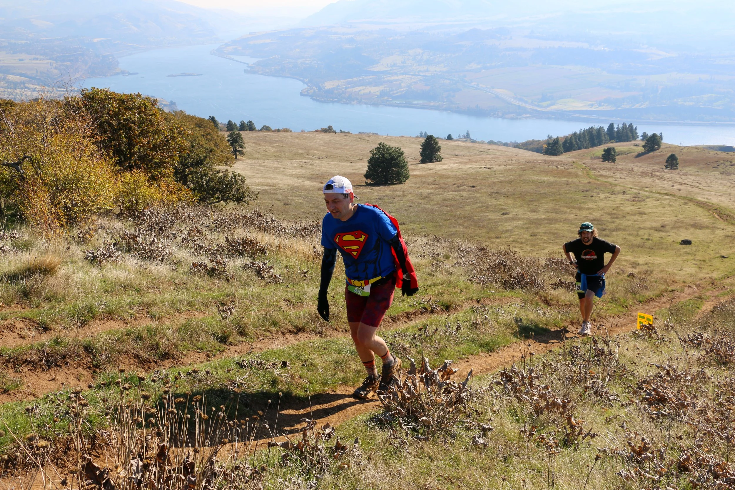
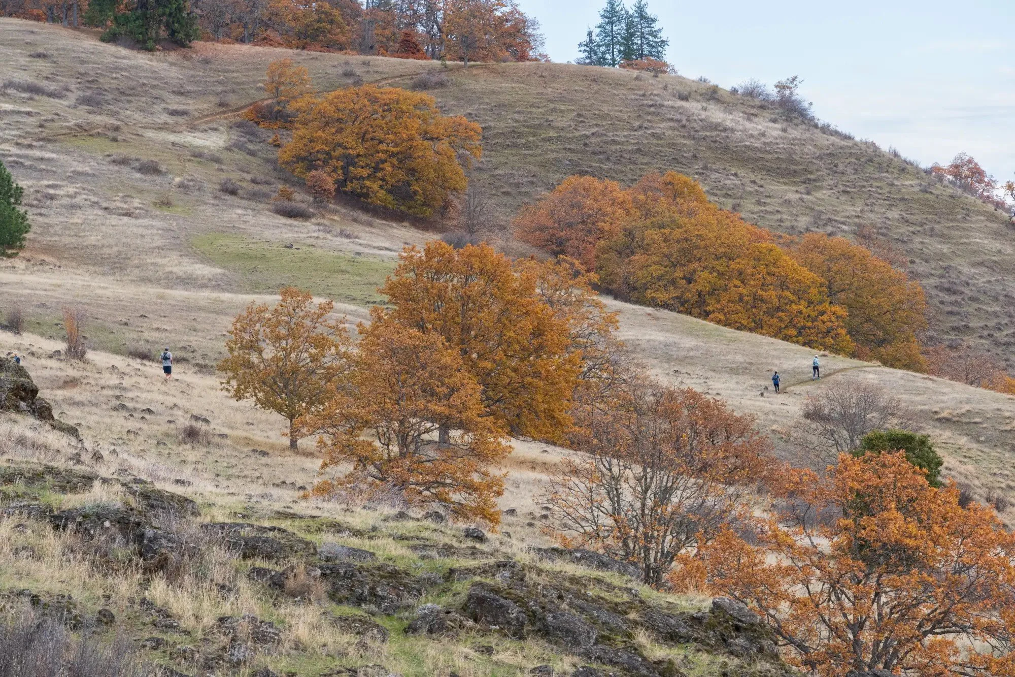
This race is a grand and thoughtfully crafted tour of this unique Cascade rainshadow ecosystem, with very little repeated trail. Mount Hood’s imposing volcanic pyramid looms large over much of the course, which flows between open Douglas fir forest, oak savanna, and grasslands with seemingly endless viewscapes of the Columbia River Gorge.
This is a rugged, steep, and sometimes technical course that will challenge even the most seasoned trail runners. This is not a closed course. The trails are open to mountain bikers, equestrians, and hikers. Please be respectful and courteous to other users. Due to steep climbs and technical terrain, this 25k is not considered a beginner’s course, and runners are therefore strongly encouraged to have prior trail running experience. This course comes in at 15.6 miles.
We can't wait to see you out in the Columbia River Gorge!
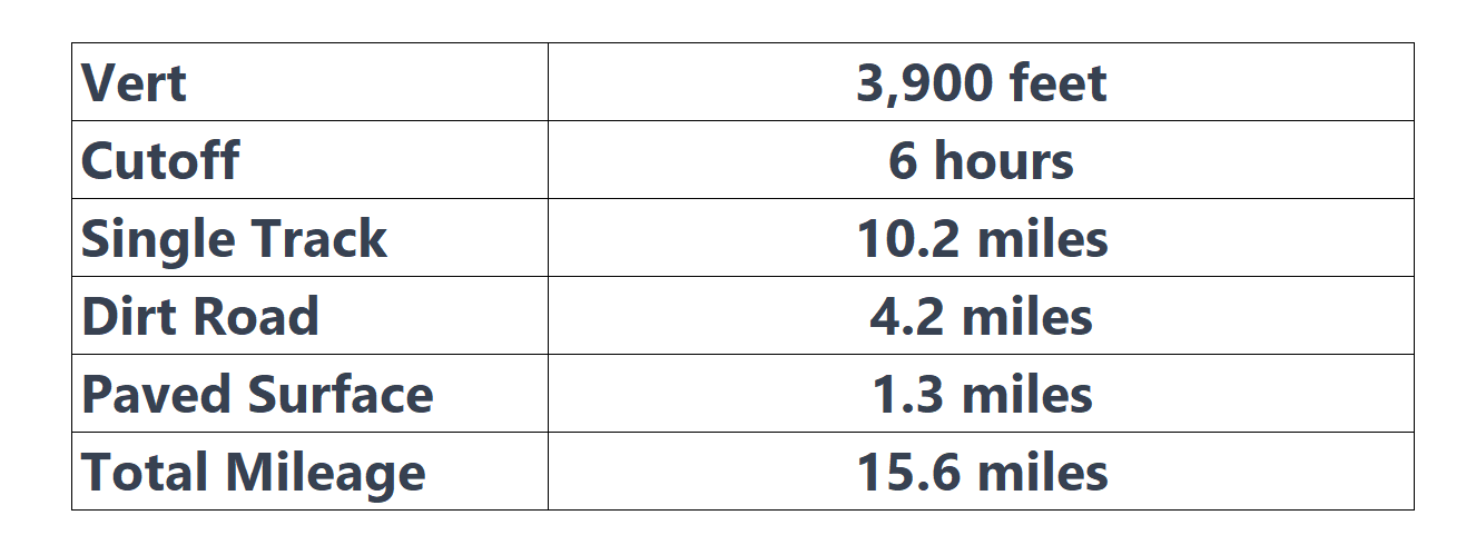
25 Kilometer Race by the Numbers
Here is an interactive map of the Coyote Wall Trail Races on Caltopo:
Aid Station Chart

Start to Catherine Creek Aid Station #1 (3.9 miles)
The start area is located at the Old Highway 8 Trail, near the back end of the Coyote Wall parking area. Starting along this mostly paved section for about 0.7 miles, runners will have a good chance to spread out by pace before turning left and beginning the spectacular climb up the Hidden Canyon Trail onto the high slopes and cliffs above the Columbia River. During this 1-mile climb, you gain almost 850 feet. A right turn onto the Loose Lucy Trail takes you eastward, descending on sweeping switchbacks through oaks and lava flows for another mile to a somewhat obscure junction at the base of a cliff. Turning left, a short, steep climb takes you through the cliffs above, before descending the rocky path roughly 0.8 miles down to the Catherine Creek Aid Station (Mile 3.9). PLEASE NOTE: You may elect to have a drop bag at the Catherine Creek Aid Station.
Catherine Creek Aid Station #1 to Catherine Creek Aid Station #2 (4.5 Miles)
From here, the course follows an old road for about 0.7 miles, crossing Catherine Creek before veering left at a Ponderosa pine-filled junction. This marks the beginning of the 3.1-mile Tracy Hill Loop. Passing through a meadow underneath some transmission lines, you begin a long and rugged climb. This segment is very technical in spots, and gains over 1,000 feet in 1.4 miles. During your climb, you will ascend through oak savanna and grasslands up onto Tracy Hill. As the trail levels out, head right and up to the crest of the ridge. From here, the views eastward to the Columbia River Gorge and south to Mount Hood are staggering. A glorious 2-mile descent through broad meadows and across the new Catherine Creek footbridge will return you back to the Catherine Creek Aid Station (Mile 8.4).
Catherine Creek Aid Station #2 to Finish (7.2 miles)
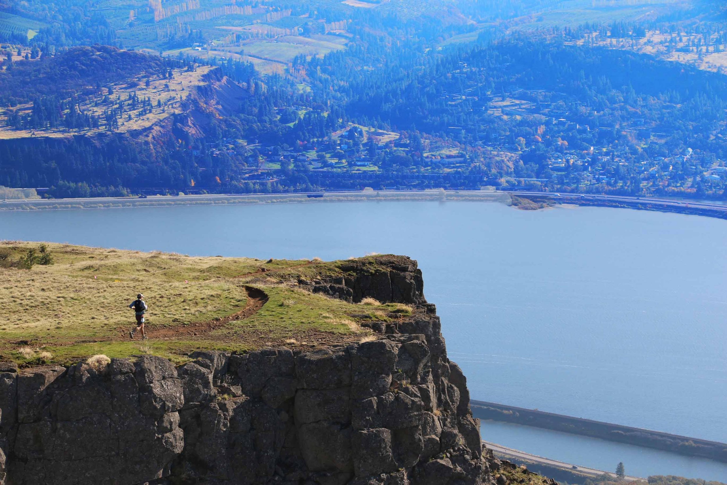
Make sure to get plenty of water and calories at the Catherine Creek Aid Station, as it is 7.2 miles from here to the finish! From here you begin the most relentless and demanding climb of the race. This rugged segment gains almost 1,100 feet in 1.6 miles. Along this climb are yet more of the breathtaking, postcard-perfect viewscapes of the Columbia River Gorge. At the top, you will arrive at a wooded junction with the Atwood Trail. Turning left at the junction, follow this relatively smooth section of trail high above the river until you reach Old Ranch Road. Turning left toward the river onto Old Ranch Road, take this winding, expansive section for just over a mile until you reach a point near the top of Coyote Wall’s grand escarpment.
Turning right and steeply up the hill from here, you reach a lofty viewpoint high atop Coyote Wall. From here, turn sharply left downhill, contouring the rim of Coyote Wall. Now begins your wild descent to the finish! From here, the course drops over 1,800 feet in just 2 miles along one of the most spectacular vistas to be found in any race! This section along the rim of Coyote Wall is stunning, but it is also very technical in sections, especially on the last 0.5 miles or so before the reaching the pavement. Tired legs and technical trails make this section challenging. It will be very important to watch your footing near the bottom of Coyote Wall. Soon you arrive back at the Old Highway 8 Trail. Turning right onto the paved pathway on which you began the race, you have only 0.5 miles left to your memorable, hard-earned finish… congratulations!!!!!
Course Description